- Home
- Telematics
- What is geofencing and how does it work?
What is geofencing?
Misuse prevention
Increased productivity
Automated updates
Geofence definition
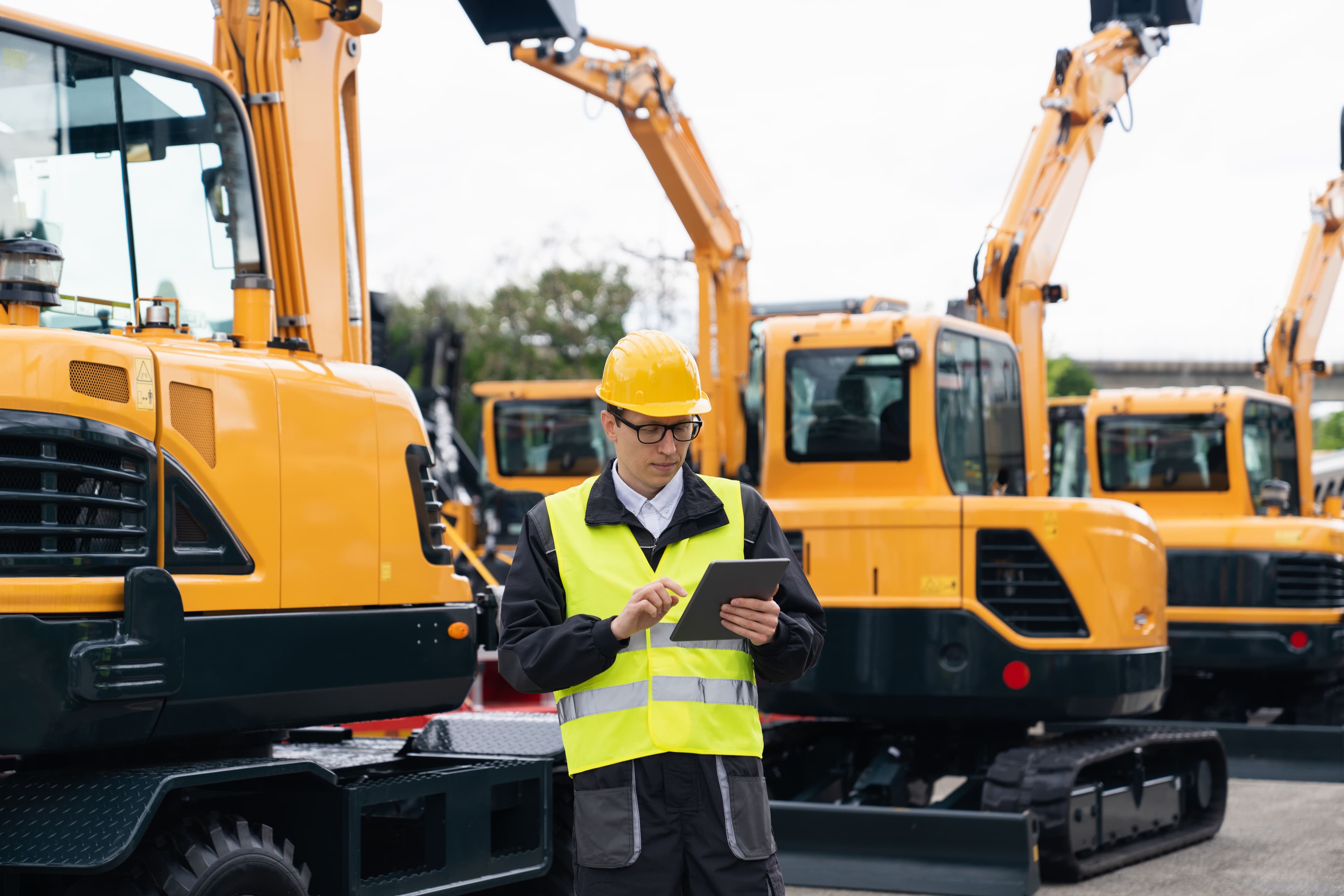
Geofence meaning involves using GPS or RFID to create virtual boundaries around specific locations. These boundaries are essential for geofence asset tracking and vehicle tracking. They enable fleet managers to monitor assets and vehicles in real time. This accurate location management improves security, optimizes routes and ensures compliance with regulations.
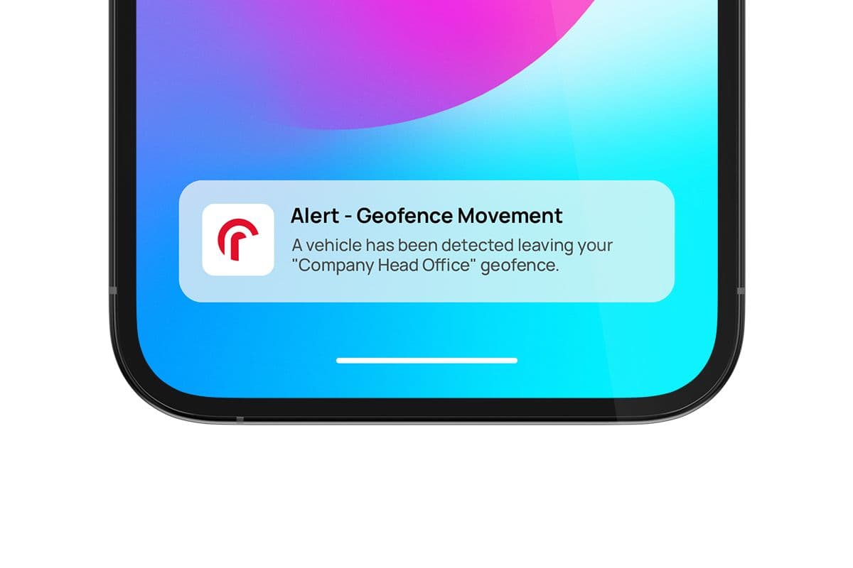
When a vehicle crosses a boundary, the system sends real-time alerts. Managers receive these alerts instantly, supporting effective asset tracking. This quick response helps prevent misuse, increase control and boost productivity.
How does a geofence work?
Boundary areas track vehicle locations in real time. With advanced tools, fleet managers can get:
- Accurate detection: Instantly know when a vehicle enters or leaves a set area.
- Prompt alerts: Receive immediate notifications when a vehicle crosses boundaries, allowing quick action.
- Enhanced oversight: Monitor vehicle movements to follow company policies and approved routes.
This technology helps fleet managers improve security, track vehicles efficiently and run operations smoothly.

Benefits of geofencing in telematics
Enhanced security
Monitor your assets in real-time and receive instant alerts for unauthorized activities. Geofence GPS trackers help reduce theft and misuse.
Route compliance
Ensure drivers follow approved routes and stay within designated areas. Geofence tracking devices minimize deviations and boost efficiency.
Operating efficiency
Ensure vehicles adhere to designated routes and schedules through virtual boundaries. This adherence reduces unauthorized detours and enhances fleet productivity.
Regulatory compliance
Geofencing helps ensure that your fleet operates within legal boundaries. By maintaining compliance, businesses reduce the risk of fines and enhance overall operational integrity.
Cost savings
Virtual boundaries help lower fuel and maintenance costs by preventing misuse.
Driver behavior monitoring
Utilize geofencing to gain insights into driver behavior within specific zones. Track adherence to speed limits, braking patterns and adherence to company policies.
What is the purpose of geofencing?
Understanding the meaning of geofence is critical to improving fleet management. Perimeter zones use virtual boundaries to alert fleet managers when vehicles enter or exit specific areas, enhancing security and efficiency.
This technology stops unauthorized use and tracks real-time vehicle movements to optimize routes. Its main advantage is improved security, allowing quick responses to unauthorized activities.
Fleet managers use territory controls to track vehicles. They receive automated alerts for specific actions, keeping them informed and in control.

How accurate is geofencing?
Virtual boundary monitoring is highly accurate. Its precision depends on three main factors: GPS quality, signal strength and clear boundaries. Radius’s Kinesis system uses advanced GPS technology to provide precise location data within a few feet.
Factors for accuracy:
- High-quality GPS: provides precise location tracking for reliable monitoring
- Clear boundaries: ensures effective tracking and oversight of vehicles
- Strong signals: reliable satellite connections enhance monitoring accuracy
- Environmental conditions: weather and obstacles can affect performance
- Reliable devices: dependable tracking tools improve consistency and accuracy
With the Kinesis mobile app, fleet managers receive real-time location tracking and reliable tools for effective fleet management. Download on Google Play or App Store to start optimizing your fleet today.
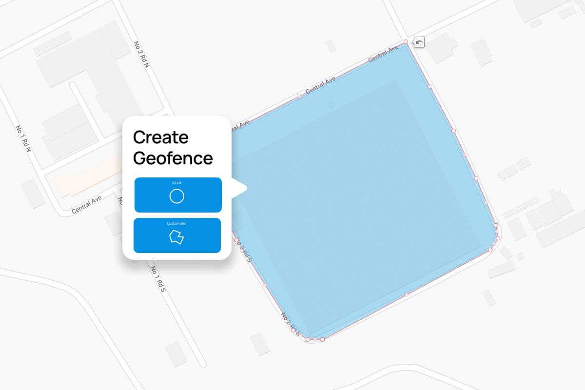
How to set up a geofence
Access the boundary tool
Log in to your Kinesis account. Select the “create geofences” button to begin.
Choose the boundary shape
Circle: This is best for round areas with clear edges. Customized: Ideal for irregular or specific shapes.
Define your location
Enter the GPS coordinates or address of the area. View and adjust the location on the map.
Set the boundary
For circles: Drag the edge to adjust the radius. For custom shapes: Click the map to draw the perimeter and fine-tune it by dragging points.
Save and activate
Click “save” to finalize the boundary. The system will immediately start logging movements in and outside of the boundary.
What are geofence alerts?
When vehicles cross set boundaries, fleet managers receive a geofence alert in their car tracking systems. You can set alerts for unauthorized movements, route compliance, or fleet activity in specific areas.
Our fleet geofence system sends alerts via email, SMS or platform notifications from your company vehicles. Trigger alerts help you respond quickly and keep your fleet running smoothly.
Boundary management alerts offer:
- Accurate detection: Instantly know when vehicles cross boundaries.
- Quick notifications: React fast to potential issues with geofence location tracking.
- Better control: Monitor fleet movements and enforce company policies.
How does geofencing relate to GPS fleet management software?
A GPS tracker geofence works seamlessly with GPS fleet management software to monitor and control your fleet effectively. Each tool plays a unique role in improving operations.
Location-based boundary software:
- Defines physical location areas like job sites or delivery zones.
- Sends alerts when the device enters or exits these areas.
GPS fleet management software:
- Tracks vehicle locations in real time.
- Optimizes routes to save time and reduce fuel consumption.
Together, these tools enhance security, boost efficiency and lower costs, making fleet management more reliable and effective.

Frequently asked questions
Can’t find an answer to your question? Talk to the Radius customer support team at 888-278-9781. We’re here to help you with any questions or concerns.
Partnership
Why choose Radius?
Radius offers easy-to-use fleet management tools to over 470,000 customers. Our virtual boundaries support efficient vehicle and asset tracking, helping save money, reduce unauthorized movements and boost security. Fleet managers rely on Radius for real-time data that streamlines operations and keeps vehicles running smoothly.